

Where to Buy in Tokyo: Shinagawa, Asakusa or the Tokyo Bay Area
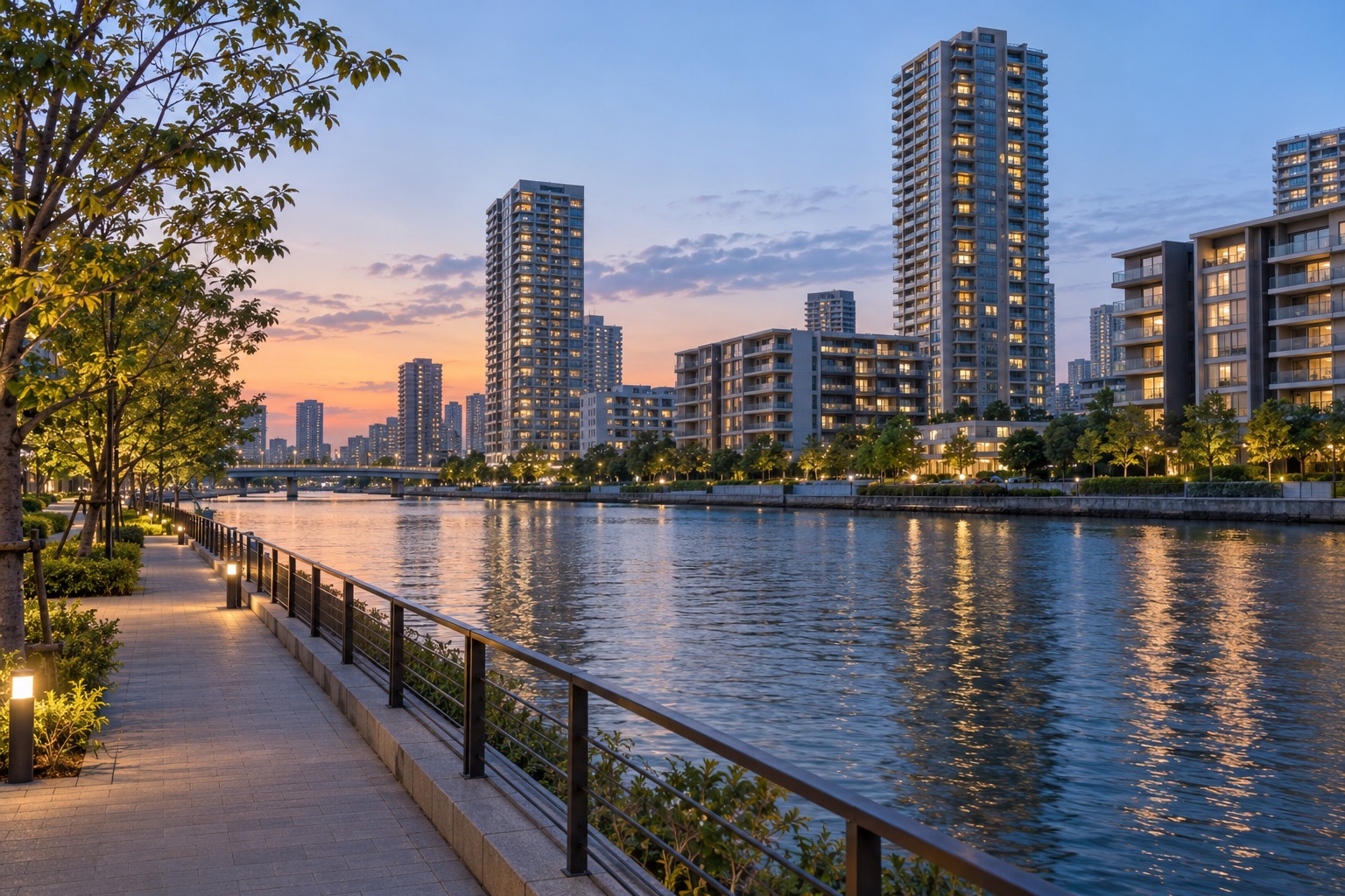
If you are buying a home in Tokyo, none of Shinagawa, Asakusa and the Tokyo Bay Area is simply better than the others; they differ in character: Shinagawa is a transport hub where the shinkansen meets the rail line to Haneda Airport, Asakusa is an old downtown district centered on Sensō-ji temple, and the Bay Area is a waterfront district on reclaimed land with many large residential developments. As of June 23, 2026, if getting around easily matters most, you could start with Shinagawa; if you want to live in an old-Tokyo neighborhood, you could start with Asakusa; if you want large new developments and building facilities, you could start with the Bay Area. This article does not rank them; it explains what to check in each, depending on your conditions.
First, what this article means by Shinagawa, Asakusa and the Bay Area
- Shinagawa: the area around JR Shinagawa Station. Note that JR Shinagawa Station itself is in Konan, Minato City, not in Shinagawa City.[1] A property described as "near Shinagawa Station" may therefore be in either Minato City or Shinagawa City.
- Asakusa: the Asakusa area of Taito City, where Sensō-ji temple stands.[2]
- Bay Area: "Bay Area" (wangan) is not an administrative name in Japan, and people use it for different areas. In this article it means Tsukishima, Kachidoki and Harumi in Chuo City, and Toyosu and Ariake in Koto City. Odaiba, Shibaura and similar areas are outside the scope of this article.
Shinagawa: a transport hub close to the shinkansen and Haneda Airport
Getting around. Tokaido Shinkansen trains stop at Shinagawa Station, which is also a station on the JR Yamanote, Keihin-Tohoku, Tokaido and Yokosuka lines, among others, and connects with Keikyu.[1] Keikyu runs direct trains to Haneda Airport.[3] Shinagawa Station is also the planned Tokyo terminal of the Chuo Shinkansen (maglev).[4] However, according to Shizuoka Prefecture material from 2024, JR Central has said it cannot open in 2027 as originally planned, and the Shizuoka section is expected to be completed in 2034 or later.[5] The opening date is still undecided, so when you buy, it is better not to count on the maglev opening soon.
Character of the area. Tokyo's 2014 urban development guidelines describe the Konan area on the east side of Shinagawa Station (around the Shibaura Water Reclamation Center) as having changed from a district of harbor warehouses into a central-city area lined with office buildings and high-rise housing.[4]
Who it suits. People who travel abroad often; people who regularly fly or take the shinkansen for work; people who work in Shinagawa or along its lines.
What to check first. Even under the same name "Shinagawa", the east and west sides of the station, and Minato City versus Shinagawa City, can look quite different. Minato City is part of the "Toshin 3" wards used in the price data below.[6] Minato City is also one of the wards covered by Tokyo's storm surge (takashio) inundation assumption map (which does not mean every location in the ward would flood); for the waterfront Konan area, look it up using the property's address.[7] Also walk the route from the property to the station yourself and look at the shops nearby.
Asakusa: life around Sensō-ji and the old downtown
Getting around. Asakusa has stations on the Tokyo Metro Ginza Line, the Toei Asakusa Line and the Tobu Skytree Line. The Tsukuba Express (TX) Asakusa Station is a separate station, a short walk from the others.[8] The Toei Asakusa Line runs through services with Keikyu, Keisei and other lines, and some trains go to Haneda and Narita airports (not every train runs through, so check the train's destination).[9]
Character of the area. This is a place with many tourists. According to Taito City's tourism statistics, Taito City received an estimated 41.21 million tourist visits in 2024 (an estimate for the whole ward, not just Asakusa).[10] When viewing a property, check the crowds and noise around it once on a weekday, once on a weekend and once at night.
Who it suits. People who like an old-downtown atmosphere and want their daily life within walking distance.
What to check first: flooding. Under the scenario of the Arakawa River flooding, Taito City's hazard map shows most of the Asakusa area inside the expected inundation zone.[11] For its river-flood scenarios, the map explains that it does not assume the Sumida River floods, because the Iwabuchi floodgate is operated. That is only a premise of the river-flood scenario: the same map also covers storm surge and inland flooding (naisui hanran), and Taito City is also one of the wards covered by Tokyo's storm surge inundation assumption map.[11][7] Expected flood depth varies by address, so check the map with the property's address, and ask which floor the building's electrical equipment is on and whether the entrances have flood protection.
Tokyo Bay Area: neighborhoods on reclaimed land
Where the land came from. Much of the Bay Area is land created by reclamation. Tsukishima in Chuo City, for example, was formed by reclamation that began in Meiji 20 (1887); Toyosu in Koto City is reclaimed land, and Ariake was formed from part of Landfill 10 (10-gō umetatechi).[12] So the Bay Area also includes older districts such as Tsukishima; not all of it is new.
Getting around. Rail access differs a lot by district. Toyosu has the Tokyo Metro Yurakucho Line and the Yurikamome; Tsukishima has the Yurakucho Line and the Toei Oedo Line; Kachidoki has the Oedo Line; and the Ariake area has the Rinkai Line (Kokusai-Tenjijo Station) and the Yurikamome. Harumi has no rail station within the district, and the Tokyo Metropolitan Government lists it as a "railway gap area" (tetsudō kūhaku chitai); residents can use buses or Tokyo BRT, or walk to a station in a neighboring district.[13] Within the same "Bay Area", the distance to a station and the lines you can use vary widely, so check them together with the property.
How the area has changed. Toyosu Market began operating on October 11, 2018.[14] HARUMI FLAG in Harumi was developed on the former site of the Tokyo 2020 Olympic and Paralympic Village. It consists of homes converted from the athletes' residential buildings and towers built new after the Games, 5,632 homes in total, and residents began moving in progressively from January 2024.[15] According to the Basic Resident Register, Harumi's population was 29,146 on June 1, 2026, and 26,154 a year earlier.[16]
Who it suits. People who want a large, newly built development and care about building facilities. Some districts have few rail lines, so check how you would get around every day.
What to check first: liquefaction and storm surge. The Tokyo Metropolitan Government publishes the "Tokyo Liquefaction Prediction Map" (revised edition released March 29, 2026), which shows the likelihood of soil liquefaction (ekijōka) in three levels for each 250 m square grid cell. It is not a prediction for a specific earthquake, and it does not state that a given spot "will definitely" or "will definitely not" liquefy.[17] Tokyo's storm surge inundation assumption map (takashio shinsui sōtei kuiki zu) also covers Chuo City and Koto City; being covered does not mean that every location in the ward will flood.[7] Look up both maps with the property's address, and ask about the building's foundations and disaster-prevention equipment.
Shinagawa, Asakusa and the Bay Area at a glance
| Shinagawa (station area) | Asakusa | Bay Area (as defined here) | |
|---|---|---|---|
| Character | Transport hub, offices and high-rise housing | Temple and old downtown, tourist area | Waterfront district on reclaimed land, many large residential developments |
| Rail | Shinkansen, several JR lines, Keikyu | Two subway lines, Tobu, TX | Varies by district; no station within Harumi |
| Check first | Minato City or Shinagawa City, storm surge inundation assumption, route to the station | Arakawa flood and storm surge inundation assumptions, crowds and noise | Liquefaction and storm surge maps, distance to the station |
Where prices roughly sit
This article only gives a rough sense of where prices sit in these three areas. The Real Estate Information Network for East Japan (REINS) divides Tokyo's 23 wards into areas and publishes contract (closed) price data for resale condos (manshon). Minato, Chuo and Chiyoda belong to the three central wards (Toshin 3-ku); Shinagawa, Ota, Meguro and Setagaya belong to the Jonan area; and the 7 wards of Taito, Koto, Sumida, Edogawa, Katsushika, Adachi and Arakawa belong to the Joto area.[6] Over the 5 months from January 2026 through May, the monthly average contract price ranged, from the lowest month to the highest, from about ¥2.20 million to ¥2.56 million per m² in the Toshin 3 wards, about ¥1.28 million to ¥1.32 million in the Jonan area, and about ¥1.00 million to ¥1.05 million in the Joto area.[6]
These are contract (closed) prices, not asking prices, and they are averages over a wide area. The Joto area includes many outer wards, so its average does not represent the price level of Asakusa or Toyosu. Tsukishima, Kachidoki and Harumi, the Bay Area districts in Chuo City, fall within the Toshin 3 wards. Within the same area, prices also vary widely with building age, floor area and distance from the station.
Floor area: Japanese listings measure it differently
If you are used to thinking about floor area and budgets the way it is done in Taiwan, check how Japan counts floor area.
- In Taiwan, for example: in the mandatory contract terms for pre-sale homes, the total registered building area is broken down into the main building, ancillary structures (such as balconies) and common parts (shared facilities).[18] According to a 2009 document from Taiwan's Control Yuan, the way the "common area ratio" was calculated was not regulated by law at the time, and practical standards varied.[19] The rules may have changed since then, so check current practice with a Taiwanese land administration agent (地政士) or a similar professional.
- Japan: condo advertisements show the "exclusive area" (senyū menseki), that is, the unit's own exclusive part, not including shared parts such as the lobby and corridors.[20] In Japan a balcony is usually a common part over which the unit owner has an exclusive right of use (the actual rule depends on each building's management rules), so it is usually not counted in the exclusive area; online advertisements for resale condos and similar listings show the balcony area separately.[21]
- Two kinds of exclusive area in Japan: the registered area is measured to the inside of the walls (uchinori).[22] Sales brochures (panfuretto) for new condos and similar materials must state, under the rules, that the exclusive area shown is the "wall-center" (kabeshin) area measured to the center of the walls, and that the registered area is smaller.[20]
So the area on a Japanese property listing cannot be compared directly with, for example, a Taiwanese title-deed area in ping. For conversion, 1 tsubo (ping) is about 3.3 m².[23] Compare homes by the usable interior size, and ask whether the area shown is the wall-center area or the registered area.
How to choose: by your conditions, not by a ranking
- You often take the Tokaido Shinkansen or use Haneda Airport: consider the Shinagawa Station area first. Asakusa also has lines running directly to Haneda and Narita.
- You want an old-downtown atmosphere with daily needs within walking distance: consider Asakusa first.
- You want a large new development and its facilities: consider the Bay Area first. But Harumi has no rail station within the district, so check how you would get around every day.
- Budget is a key condition: average contract prices per m² differ a lot by area, but an area average does not represent any particular street, so compare specific properties.
- You are buying to rent out: the criteria differ from buying to live in. Check rental demand and how the unit would be managed with your agent.
When this conclusion may change. If the hazard maps for the property's address show unfavorable results, or if the places you go often (work, school, the airport) are in another direction, the suggestions above may not apply. Properties within the same area can also differ a lot, so in the end compare individual properties.
What to confirm with your agent or a professional
- The results for the property's address on the flood, storm surge and liquefaction maps
- Whether the area shown is the wall-center area or the registered area, and how large the balcony is
- The actual walking route to the nearest station and the lines you can use
- The amount of the management fee (kanrihi) and the repair reserve fund (shūzen tsumitatekin, a monthly payment for the building's long-term repairs), and any plans to raise them
- For tax, loans, visas and similar questions, consult a tax or legal professional separately; this article does not cover them
Start looking at Tokyo properties
SORA lists properties in Tokyo and across Japan. You can browse current listings or start with the Tokyo area guide.
Sources
- Shinagawa Station information, Tokaido Shinkansen (JR Central)
- About Sensō-ji (Sensō-ji)
- Haneda Airport access guide (Keikyu, data as of April 1, 2025)
- Shinagawa Station and Tamachi Station Area Urban Development Guidelines 2014 (Tokyo Metropolitan Government, September 2014)
- Linear Chuo Shinkansen, Shizuoka section (リニア中央新幹線静岡工区) (Shizuoka Prefecture, updated April 30, 2024)
- Monthly Flash Report Market Watch, May 2026 data (Real Estate Information Network for East Japan, June 2026)
- Storm surge inundation assumption area map: explanatory material (Bureau of Port and Harbor, Tokyo Metropolitan Government, revised December 2024)
- Sensō-ji: Access (Sensō-ji); Tsukuba Express Asakusa Station (Metropolitan Intercity Railway Company)
- Toei Transportation media guide (Bureau of Transportation, Tokyo Metropolitan Government, data as of April 1, 2026)
- Taito City Tourism Statistics, Reiwa 6 (Taito City, November 25, 2025)
- Taito City hazard maps (flooding and landslides) (Taito City, map issued May 2026)
- Origin of the name Tsukishima (Chuo City, January 18, 2023); Place names of Koto City (Koto City, July 13, 2024)
- Tokyo Metropolitan Government, subway-related materials (Tokyo Metropolitan Government, November 2022); Tokyo BRT; Tokyo Metro Toyosu Station; Tokyo Metro Tsukishima Station; Toei Subway Kachidoki Station; Toei Transportation media guide (Oedo Line); Rinkai Line; Yurikamome
- About Toyosu Market (Tokyo Metropolitan Central Wholesale Market)
- Harumi 5-chome West District (former Athletes' Village) development fact sheet (Tokyo Metropolitan Government, September 2024)
- Chuo City population by town and block (June 1, 2026); same (June 1, 2025) (Chuo City)
- Tokyo Liquefaction Prediction Map (Tokyo Metropolitan Government, revised edition released March 29, 2026); Liquefaction Prediction Map explanation (Tokyo Metropolitan Government, March 2022)
- Mandatory and prohibited terms for standard pre-sale home purchase contracts (Ministry of the Interior, Taiwan; latest amendment announced June 19, 2023; published on the Executive Yuan website)
- Control Yuan member press release: public facilities padded into floor area (Control Yuan, September 3, 2009)
- Fair Competition Code for Real Estate Representations and Enforcement Rules (code version in force from October 1, 2024); Enforcement Rules, appended tables (version in force from September 1, 2022) (National Federation of Real Estate Fair Trade Councils)
- Standard Management Rules for Condominiums (single-building type) (Ministry of Land, Infrastructure, Transport and Tourism, revised October 17, 2025); Enforcement Rules of the Fair Competition Code for Real Estate Representations, appended tables (National Federation of Real Estate Fair Trade Councils)
- Real Property Registration Rules, Article 115 (Ministry of Justice, e-Gov Law Search)
- Calculated from the conversion example in the Control Yuan member press release (139.85 m² = 42.305 ping)
Related articles
 Topics
SORA Forms a Business Alliance with Baashir Advisory Group in Hong Kong
SORA Co., Ltd., the operator of realestatejapan.jp, has entered into a business alliance with Baashir…
October 6, 2026
 Guide
GuideBefore You Buy a ¥100 Million Condo in Japan: Documents to Request
Before you make an offer on a resale condominium in Japan, ask your agent for four documents: the management…
October 6, 2026
 Guide
GuideSecond Homes Near Tokyo: Karuizawa, Kamakura and Atami
Karuizawa, Kamakura and Atami are each about 45 to 70 minutes from Tokyo Station by train on official travel…
August 11, 2026